The Macon Levee
Friends of Ocmulgee Old Fields
The Macon Levee in 2008
Trees removed to strengthen Macon's leveeNovember 2008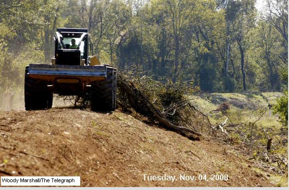 A skidder pulls a load of trees
Tuesday that were
removed from within 4,000 feet of the Macon levee near the sewer
treatment plant. Contractors have been removing trees from a wooded
section of Macon’s levee for a week in an effort to bring it up to
federal standards so property behind it can maintain federal flood
insurance coverage.
Woody Marshall/The Telegraph
|
||
|
A skidder travels along the top of
the Macon levee
near the sewer treatment plant Tuesday. The Macon Water Authority is
clearing trees from within 4,000 feet of the levee in an effort to
bring it up to federal standards so property behind it can maintain
federal flood insurance coverage.
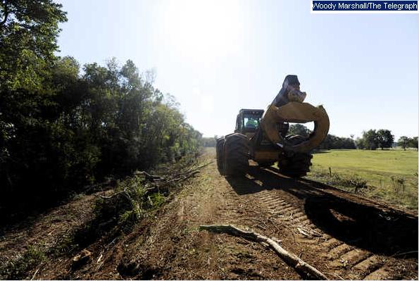 Woody
Marshall/The Telegraph
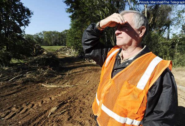 Randy Smith with the Macon Water Authority watches a skidder pull trees that were removed from within 4,000 feet of the Macon levee near the sewer treatment plant Tuesday. Contractors have been removing trees from a wooded section of Macon’s levee for a week in an effort to bring it up to federal standards so property behind it can maintain federal flood insurance coverage. |
||
http://www.macon.com/198/story/513963.html
Tuesday, Nov. 04, 2008Trees
removed to strengthen Macon's levee
|
||
| |
||
 |
||
| From: "John
Wilson" <bullsmountain@yahoo.com> To: "Joyce Bear" <preservation@muscogeenation-nsn.gov> Cc: "Jim David" <Jim_David@nps.gov>, Subject: Macon Levee Improvements Date: Mon, 24 Nov 2008 12:17 Hello Joyce,
I have gathered and attached some information to highlight
the Corps'
ongoing involvement in strengthening the Macon Levee and its
adverse impacts
on the Ocmulgee Old Fields' TCP, the Ocmulgee National
Monument and Lamar
Mounds.
The whole focus of the Corps has been and continues to be
the protection of
the western floodplain, behind the Macon Levee. The Ocmulgee
Old Fields TCP
includes portions of the Macon Levee, including the tree
removal area.
However, the Ocmulgee National Monument, Lamar Mounds and
the majority of
the TCP are in the eastern floodplain. The Macon Levee
increases the
magnitude and frequency of flooding in the eastern
floodplain. Therefore,
any and all efforts to maintain and improve the Macon Levee
negatively
impact the TCP and National Park properties. The Macon Levee
is a federal
project and the Corps conducts routine inspections, which
are federally
funded (see 2000 federal funding attachment). They review
and approve local
modifications to the Levee, such as the shear escarpment
repair (see Shear
Escarpment attachment), which was repaired through the
construction of the
Heritage Trail alongside and on top of the levee. A pending
second phase of
the Trail will pave the top of the Levee through Central
City Park and I'll
bet there has been no consultation regarding this project,
located in the
TCP either. The Corps has "required" the escarpment repair
and tree removal
project under threat of "decertifying" the Macon Levee as a
federal project.
So, although the Corps may not have an official Levee study
at the present
time, the Corps is actively involved in this federal
project. However, Corps
documents (see 2002 Sand Boils attachment) indicate that the
Corps is still
operating under "the ongoing Section 205 study." This study
could be the
1997 Section 205 Study, which the Corps had issued public
notice of its
completion, but then withdrew it when the benefits/cost
analysis proved to
be negative. The Sand Boils section of the Macon Levee is
also located
within the TCP.
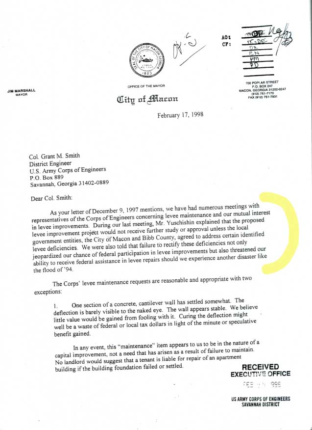
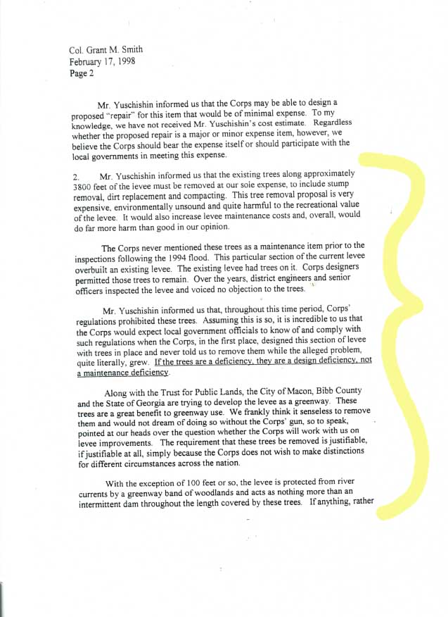
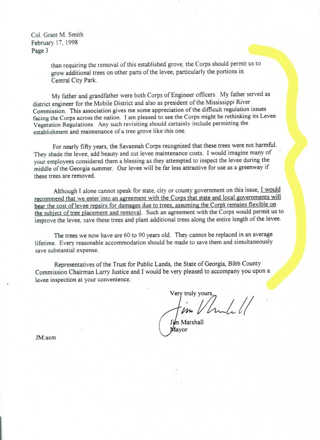
The attached 1998 letter to the Corps from former Macon
Mayor (now
Congressman) Jim Marshall clearly states the case that the
trees along the
levee are older than the levee, should not be considered a
maintenance issue
and should not be removed. He also states their value for
the future
Heritage Trail expansion. His letter also mentions that the
Corps is
"rethinking its Levee Vegetation Regulations" to allow trees
on levees. The
Corps sent the Mayor documents relating to this
"rethinking," which I have seen.
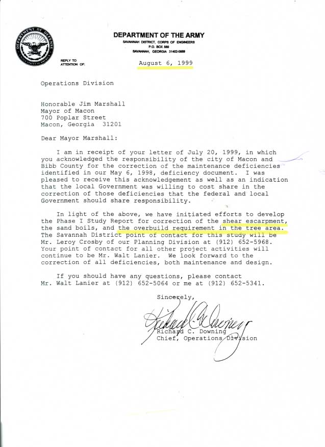
   A viable alternative to removing the trees was to widen the
Macon Levee in
the tree area and this seemed to be an agreed upon solution,
as referenced
in a 1999 Corps letter to Mayor Marshall. (see attachment
"Widen instead of
remove trees"). This attachment also mentions that the Corps
is developing a
Phase 1 Study Report.
 In conclusion, the Macon Levee is a federal project, which
receives ongoing
federal involvement, funding and permitting. The Corps did
not update the
maintenance plan for the Macon Levee when the TCP was
designated. The TCP
was designated national register eligible for the purpose of
recognizing and
protecting its cultural and natural resources. These
protections clearly
apply to any projects with federal involvement. Mowing grass
and cutting
down trees are acceptable maintenance operations, but
bulldozing mature
trees and digging up their roots should not be considered an
acceptable
maintenance activity in the TCP. If this is acceptable, what
is an
unacceptable activity in the TCP? This is especially
unacceptable when two
alternatives have been proposed to eliminate the need for
any tree removal
by heavy equipment - (1) widening the levee in the tree area
and (2)
subdividing the levee. A couple of years ago, the City of
Macon and
Congressman Marshall asked the Corps to investigate
subdividing the Macon
Levee, as a Section 1135 (Floodplain Restoration) and
Section 205 (build
subdivider levee & strengthen upper part of existing
levee) project. This
"solution" would protect existing businesses behind the
Macon Levee and
would reduce the excessive flooding in the Ocmulgee National
Monument, Lamar
Mounds, the TCP and up- and down-stream homes, businesses
and roads. The
$250,000 the MWA is spending on this tree removal project
could have gone a
long way to providing the local match for this Section
1135/205 study.
Instead, it has strengthened the case against subdividing
the Levee and a
news article stated the Corps had determined a ring levee
around the
treatment plant was infeasible, which indicates a Corps
study was performed.
This Section 1135/205 Study and Project could and should be
funded through
the FHWA/DOT as cumulative mitigation for the current
I-16/I75 Improvement
project, which includes I-16 through the Ocmulgee National
Monument. (see
attachment "10 1996 get DOT or FHWA to fix it")
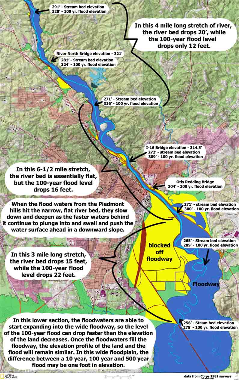
 The Corps has determined that I-16 raised 100-year flood levels by 3 to 4 feet in the Ocmulgee National Monument (see attachment "Dredging alternative"). The Macon Levee was also raised by three feet, as part of the construction of 1-16, to offset its resultant increase in flood levels. There is a fundable solution. 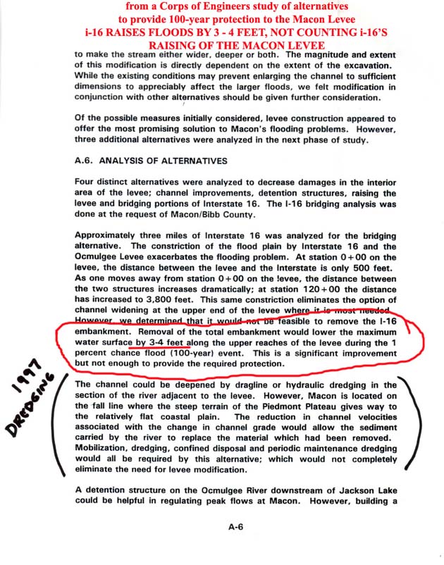 According to the Corps and USGS flood data, the Macon Levee
/ I-16 has
raised 100-year flood levels in Macon by five feet or more
at the 5th St.
Bridge. (see attachment "flood graph")
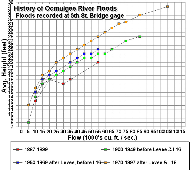 In fact, Macon now gets a 100-year flood every ten years (in frequency) due to I-16 and the Macon Levee. (see attachment "03 1996 100") Seventy percent of the Ocmulgee floodway, immediately below downtown Macon, has been impaired or completely blocked off by levees. A Section 1135 project could reduce this from
70% to 24% and greatly relieve Macon's flooding problems, but the Corps
sole focus is on maintaining this problem. (see "Full Flood Profile
Map" and related "Floodway restoration" spreadsheet.)
RECOMMENDATIONS:
1. Stop the tree removal project immediately. New
maintenance guidelines
cannot be developed if the maintenance improves the chances
of the Macon
Levee surviving a flood, at the expense of increased
flooding to the
Monument and TCP.
2. Hold a meeting to discuss the Macon Levee & the I-16
project at the
Ocmulgee National Monument, with the public, the FHWA, DOT,
Corps, NPS,
USF&W, DNR, Macon, Bibb, Jones, MWA, Muscogee Nation and
other affiliated
Native American entities participating. There are viable
solutions and
funding opportunities.
3. Until there is a change in Corps focus, I believe the
Muscogee Nation
should oppose the tree removal project and seek compensatory
mitigation,
should oppose the paving of the new Trail on the Levee in
the TCP, oppose
any future "sand boils" repairs on the levee, ask the FHWA
to mitigate for
the excessive flooding caused by I-16 in their current
I-16\I-75 project and
request an EIS for the project. The Ocmulgee National
Monument should also
be asked to support these efforts to protect the Monument
and the TCP.
Thank you,
John Wilson
|
||